

Bridging Our City's Road Rivers
We have a few road rivers in our city - Highway 20, Peachtree Industrial Boulevard and the railroad impede pedestrian access. We'll have an opportunity to bridge one in October.

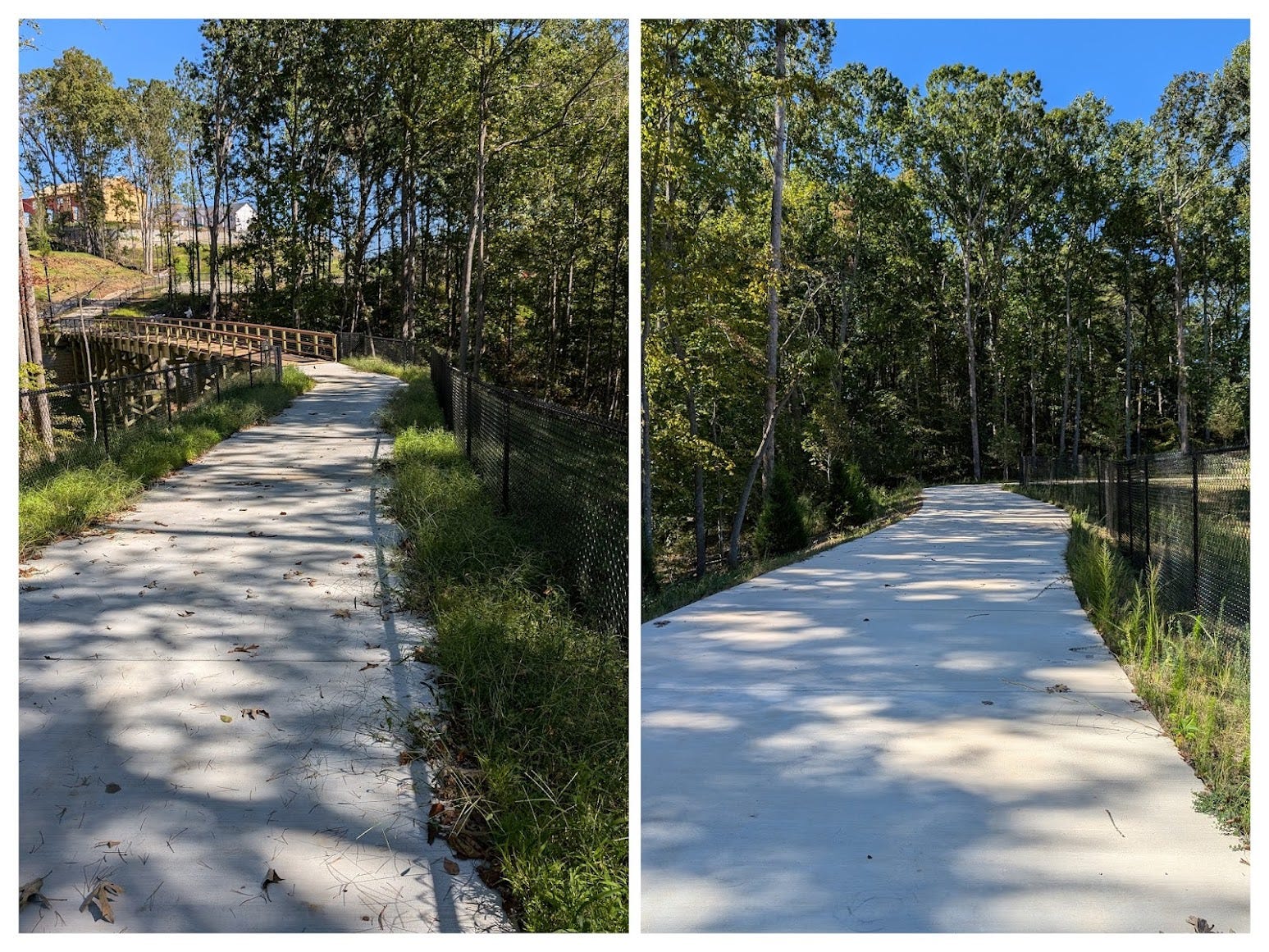
In October, City Council will have the opportunity to literally bridge one of our city’s road rivers by awarding a construction contract for the greenway pedestrian bridge across Highway 20. Highly traveled roads are like rivers - they become a physical barrier to those outside of their cars (and often even for those in their cars). Like rivers, you can attempt to cross on foot but at great risk.
The pedestrian crossing of Highway 20 has been a consideration going back at least 20 years. Even though the widening of Highway 20 was more than a decade away at the time, the 2005 Town Center Master Plan rightly considered that a widened Highway 20 would present a physical barrier between the north side of the city and south side of the city to anyone not in a car. In fact, pedestrian access was the main focal point of the final discussion in the 2005 plan.
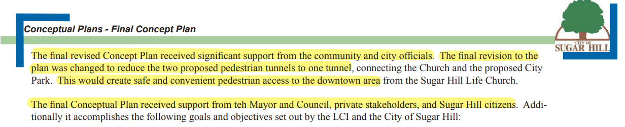

While the pedestrian tunnel was curiously removed from the plan in 2011, which was discussed at length in a previous article, the need for pedestrian access across Highway 20 was brought back in the 2016 Sugar Hill Greenway Master Plan.

Because the city’s planning efforts are coordinated and consistent, the 2017 update to the downtown master plan also included the bridge with more than 20 mentions of the bridge in the report. It also included a detailed discussion on it, which is shown below.
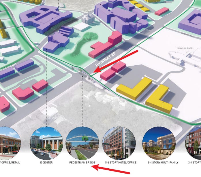
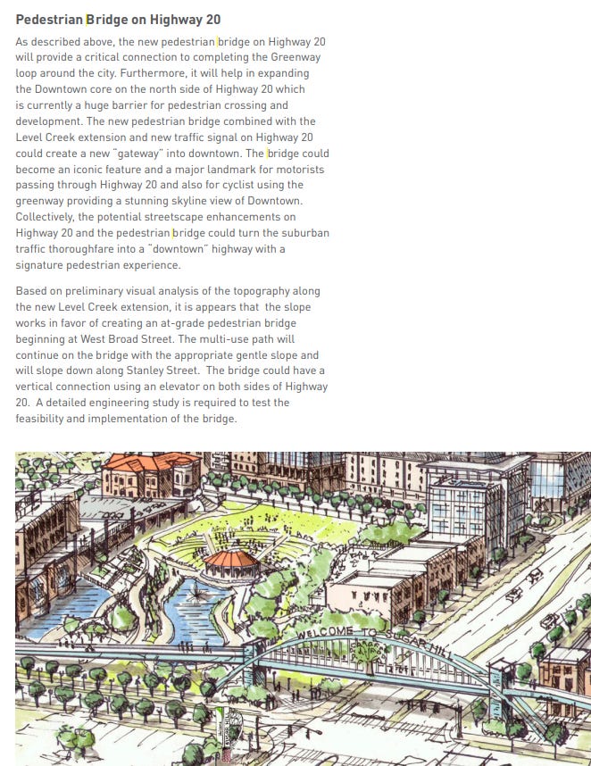
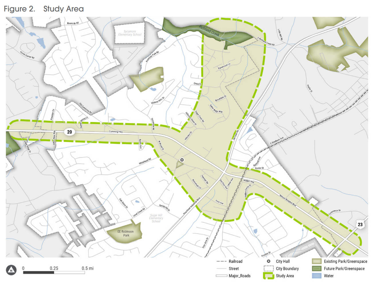
The planning efforts continued into a much more detailed fashion with a concept plan conducted in 2020 of the greenway along Highway 20 between Ridge Lake Park and Buford Highway east and west as well as downtown along Hillcrest Drive to Richland Creek north and south.
This study included more detailed information about the greenway as well as improvements that would further refine the plan.

The pedestrian bridge is discussed extensively in the 2021 Downtown Mobility Study. While that study was referenced for the “What’s in a Traffic Light” article, downtown mobility obviously is heavily pedestrian and bike oriented.

Finally, Envision100, which was the city’s comprehensive plan update adopted this year, also acknowledged the need for the bridge and pedestrian facilities.


Pedestrian access within the downtown halo goes back decades of planning. In the 2008 Comprehensive Plan update, under transportation, the stated main objective was, “The goal is to create an environment within the city that is more pedestrian-oriented and less automobile-oriented.”

That covers much of the history of the planning efforts over the last 20 years.
From a budget standpoint, the bridge appeared in the oldest available budget on the city’s website as part of the Capital Improvement Budget in 2016.

The bridge has been in the capital program budget every year since then. Here is the 2024 approved capital budget spreadsheet.


The source of funds includes general fund, which is actually American Rescue Plan Act funds that were set aside in 2022 for the construction of the bridge.
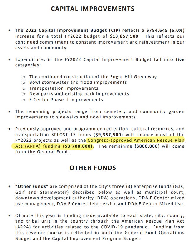
The bridge itself connects the southern portion of the greenway to an additional mile of greenway that has been built on the northside of Highway 20.
This northern portion of the greenway will provide more than 1,800 homes direct access to the greenway and downtown via the pedestrian bridge within the vicinity of Hillcrest Drive and Stanley Street. Even at just 1.5 people per home, that’s over 10% of the city’s population with safe pedestrian access from the northside of Highway 20 to the over 5 miles of greenway south of Highway 20 and downtown. In addition, it will give residents and visitors within downtown and along Level Creek Road and Whitehead Road easy, safe access to the northern portion of the greenway, including the commercial property at the intersection of Stanley Street and Highway 20 that received Design Review Board approval in September.

The bridge provides more than 1,500 homes within a mile of downtown on the south side of Highway 20 direct access to the northern portion of the greenway as well as the developing commercial node at Stanley Street via the pedestrian bridge.
The bridge itself will not only provide safe, convenient pedestrian access to downtown, it will become an iconic structure within the city. Already, family photos, prom photos and homecoming photos have become a tradition within our downtown for local residents. This will become yet another beautiful structure that will no doubt be a selected location for photos and another way that residents and businesses will identify with our city.
The proposed bridge will not require an elevator to access and will allow bicycles, wheelchairs and other mobility challenged individuals the ability to access the bridge without the need for an elevator or negotiate stairs. This makes the bridge truly pedestrian and bicycle friendly and continues the intent and spirit of the greenway itself.
Finally, one of the most important, if not the most important, benefits of the bridge is safety. As previously mentioned, there are more than 3,000 total homes within one mile of the bridge. That’s thousands of residents who have to deal with the river that is Highway 20. Crossing Highway 20 in a car is a dangerous proposition, let alone on foot. The most recent year traffic counts in 2023 from GADOT was 37,800 vehicles a day on Highway 20 within the vicinity of downtown.

The widening of Highway 20 between Peachtree Industrial Boulevard and Buford Highway from four to six lanes will undoubtably bring still more traffic to this stretch of Highway 20. And it should be expected that someday Highway 20 between Peachtree Industrial Boulevard and the Chattahoochee River will, unfortunately, be widened from four to six lanes as well.
Here are two videos of the current pedestrian experience crossing Highway 20 at non-rush hour. It’s not a comfortable feeling to cross a road where speeds regularly eclipse 50 MPH, which is lethal to pedestrians. Many of the vehicles on Highway 20 are semis as it’s the last crossing of the river before Lake Lanier. Crossing at a normal speed left just 10 seconds after making it across before the light would cycle back to green. Imagine crossing that in a wheelchair, with children or for an individual who has limited mobility.
In fact, pedestrian deaths are on the rise in a significant way. According to Insurance Institute for Highway Safety (IIHS), pedestrian deaths are up 83% since hitting a low point in 2009.
Distracted driving, especially due to phones, is also on the rise. The website Smart Growth America highlights pedestrian dangers in its report “Dangerous By Design” but does make the point that safe streets benefit everyone, including drivers. The bridge itself removes a “conflict point” by grade separating vehicles from pedestrians and bicyclists. Additionally, pressing the pedestrian button adds an additional 30 seconds to the light cycle, delaying traffic on Highway 20.
The long-awaited greenway bridge over Highway 20 is set to offer safe passage over the busy thoroughfare, bridging the northern and southern parts of our city. This bridge will enhance the city's vibrancy and distinctiveness, while also yielding economic advantages by enabling thousands of residents to conveniently reach downtown and the Greenway without relying on their cars.
The greenway bridge makes us a Strong Community and yet another reason to Love Where You Live.
I cannot wait! I will use this bridge a lot.
It’s still a rather steep expense to just give you a little more pavement for exercise. We have miles and miles of greenway and additional sidewalks for that. I can find plenty of space already available to stretch my legs without asking for additional tax money to fund my recreation.