

The 2011 LCI Plan: The first appearance of "Aging in Place" and an unfortunate deletion
2010 and 2011 was a year of transition with major city construction downtown and preparations for the widening of Highway 20 that included the unfortunate removal of a critical infrastructure piece.

As 2010 and 2011 rolled in, the effects of the Great Recession continued to ripple through the community. However, that didn’t stop Sugar Hill from progressing on its vision for downtown.
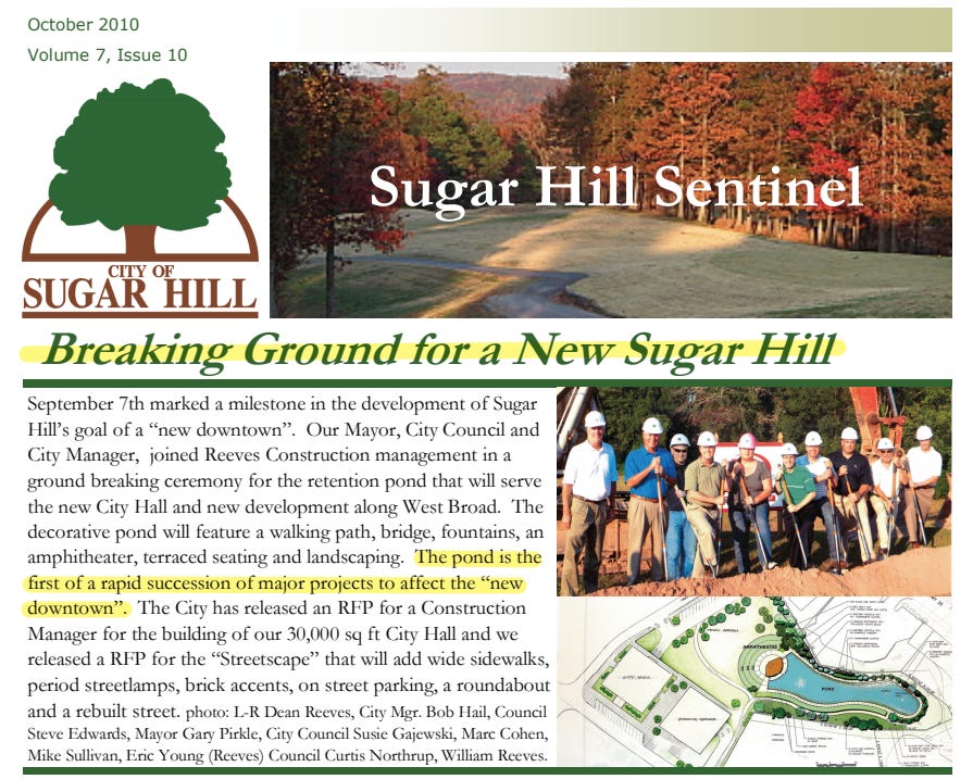
In October 2010, the city broke ground for “a New Sugar Hill” as heralded in the October 2010 edition of Sugar Hill Sentinel. The city began construction on what is now referred to as “The Bowl at Sugar Hill” - the amphitheater and amenity pond that was designed to serve as stormwater management for the future development of the eastern half of West Broad Street/Hillcrest Drive area of downtown.
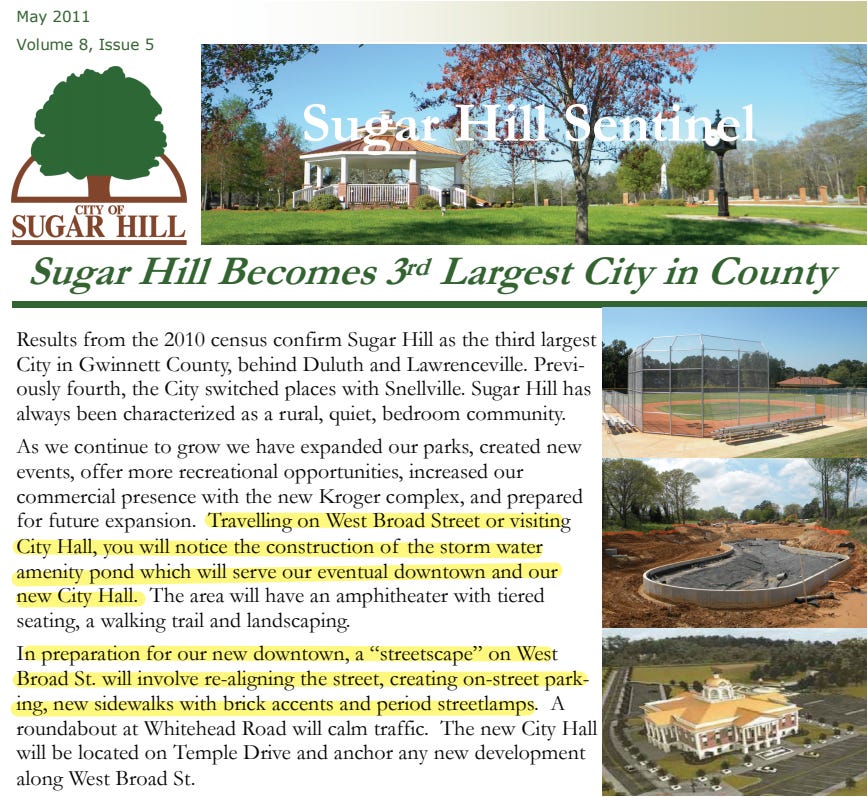
Sugar Hill’s growth rate from 2000-2010 continued at a staggering rate growing from 11,399 residents in 2000 to 18,522 residents in 2010, a 62.5% increase. This was the third largest increase in population in a decade trailing the 80s, when the population increased 84.3% and the 90s, when the population increased 250.1%. The city declared the news in its May 2011 edition of the Sugar Hill Sentinel noting the city had become the third largest city in Gwinnett - trailing just Lawrenceville and Duluth and eclipsing Snellville in size.
The news included a forward look to the new downtown, celebrating the re-construction of West Broad Street in preparation for the coming developments.
As 2011 continued, the city completed a minor update to its Livable Centers Initiative (LCI) plan for downtown. The update was not particularly groundbreaking like the 2005 initial plan and is just 12 pages in length. However, we see the first introduction of a term that is used often to describe the purpose of the development of downtown and additional housing types and options - an “aging in place community”. Aging in place community simply means that there are housing types that if a resident desires to live their entire life in the same community, there are housing types and options that will accommodate the seasons of life of that resident.
In that context, the city adopted new zoning classifications to encourage senior living in downtown along with a zoning classification for “mixed use development through more urban use provisions and design standards.”

The city also noted the improvements to realign Church Street with Level Creek Road to, “improve safety and visibility for drivers and pedestrians”, an upgraded crosswalk at the Community Center and streetscape improvements to West Broad Street. These changes mirroring closely with the improvements currently under construction on the realignment of Alton Tucker Boulevard, Level Creek Road and West Broad Street as well as the plan for West Broad Street 2.0.

The city also indicated an unfortunate deletion from the 2005 project list - the removal of the pedestrian tunnel under Highway 20.
Of other note, the plan also discussed the need for public art as well.

The removal of the tunnel was a huge mistake. Highway 20 had not yet been widened and the time to plan for the construction of the facility to grade separate pedestrians from cars going 45+ MPH was prior to its construction. The city doesn’t give any reasons on why the “element is no longer viable” - it was simply a statement. The cost for the tunnel in the 2005 plan was estimated at $1 million - something that could have been easily accommodated through SPLOST funding or grants.
Grade separation to connect the north and south sides of the city across what is a river of fast-moving vehicles is of critical importance. So much so, that a pedestrian bridge to connect those two sides is under design now with plans for the bridge to be put out for request for proposals (RFP) from construction companies expected to happen later this year.
That grade separation will accomplish two important goals, along with a host of others. First, the safety of the large number of people who desire to access downtown by walking or biking for those in the northern portion of the city will be accommodated. The southern portion of the city will be connected to the north for the future commercial development that was required with the rezoning of the property along Stanley Street. Second, it will improve the flow of vehicles on Highway 20 as pedestrians and bicyclists won’t have to cross Highway 20 on foot. The activation of the pedestrian button at intersections causes the light cycle to last 2-3 times longer than it otherwise would.
Other goals of grade separation provide a continuous safe loop for the future extensions of the Sugar Hill Greenway. The mixed-use developments to the north of Highway 20 were required to construct the greenway through their developments which will add some 3/4 of a mile of new greenway to the already existing 5 miles.
It’s unfortunate that the tunnel was removed from the plan, however, the new pedestrian bridge will still accomplish the goal of grade separation and allowing safe, easy access across Highway 20 - improving the continued expressed goals of a walkable community and decreasing vehicular delays on Highway 20.
The curious thing about this LCI update is that it didn’t apparently include any public input - which is unusual. And there was no action taken on it by Mayor and Council or even discussion indicated in a review of minutes from Mayor and Council meetings from 2011 into early 2012. The date on the LCI update is September 2011. Why these weren’t discussed, and the public was not invited to provide feedback on it is curious.
The only public action taken in 2011 related to this occurred in December 2011 when Mayor and Council adopted the zoning overlays for downtown unanimously.

The entire 2011 LCI update can be downloaded below.

The 2010-2011 updates and investments show that Sugar Hill was continuing on its journey to become a Strong Community with the investments giving residents even more reasons to Love Where They Live.